
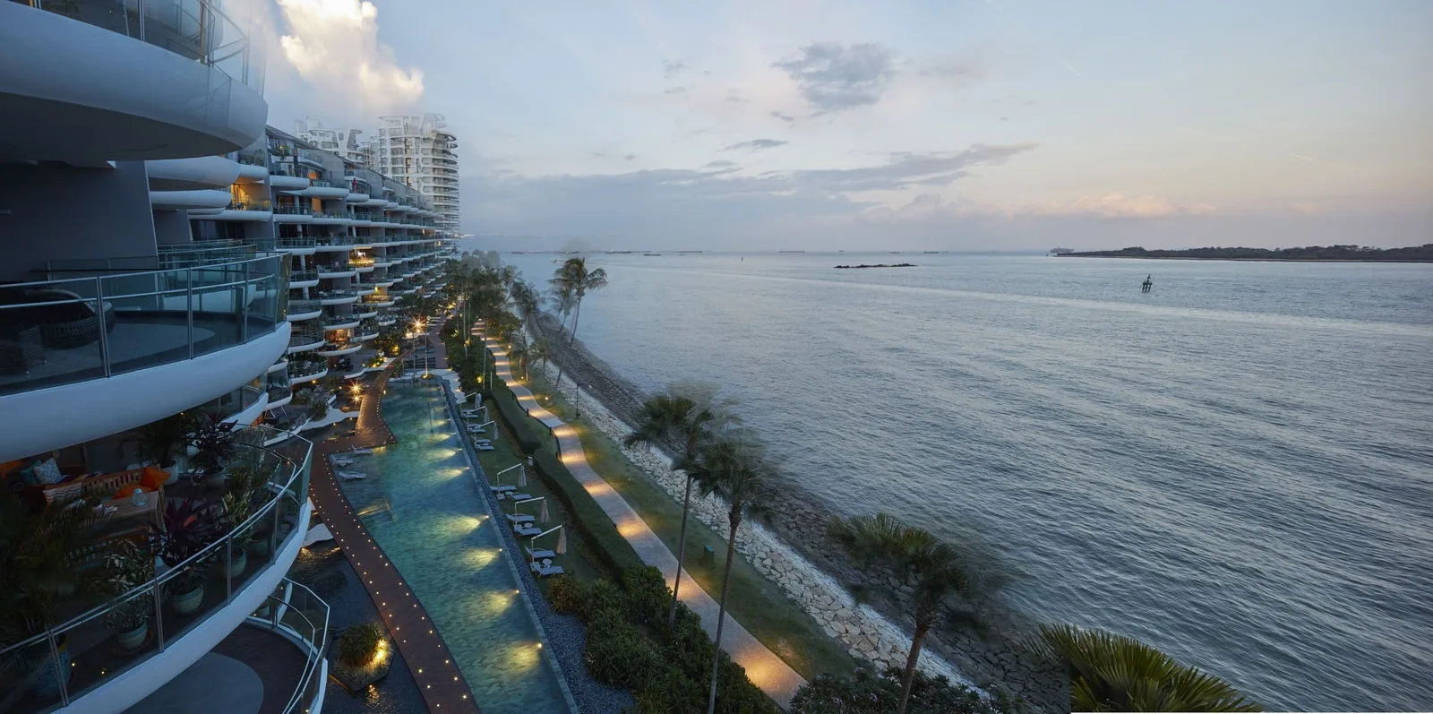
 Photograph
Seascape stands at 57 and 59 Cove Way, at the southern tip of Sentosa Cove in District 4, facing the sea and the Southern Islands. HarbourFront MRT station is about 3.4 kilometres away in a straight line and about 4.9 kilometres by road.
Seascape on the Map
Map centred on the site (1.23984, 103.83793). Open Seascape in Google Maps.
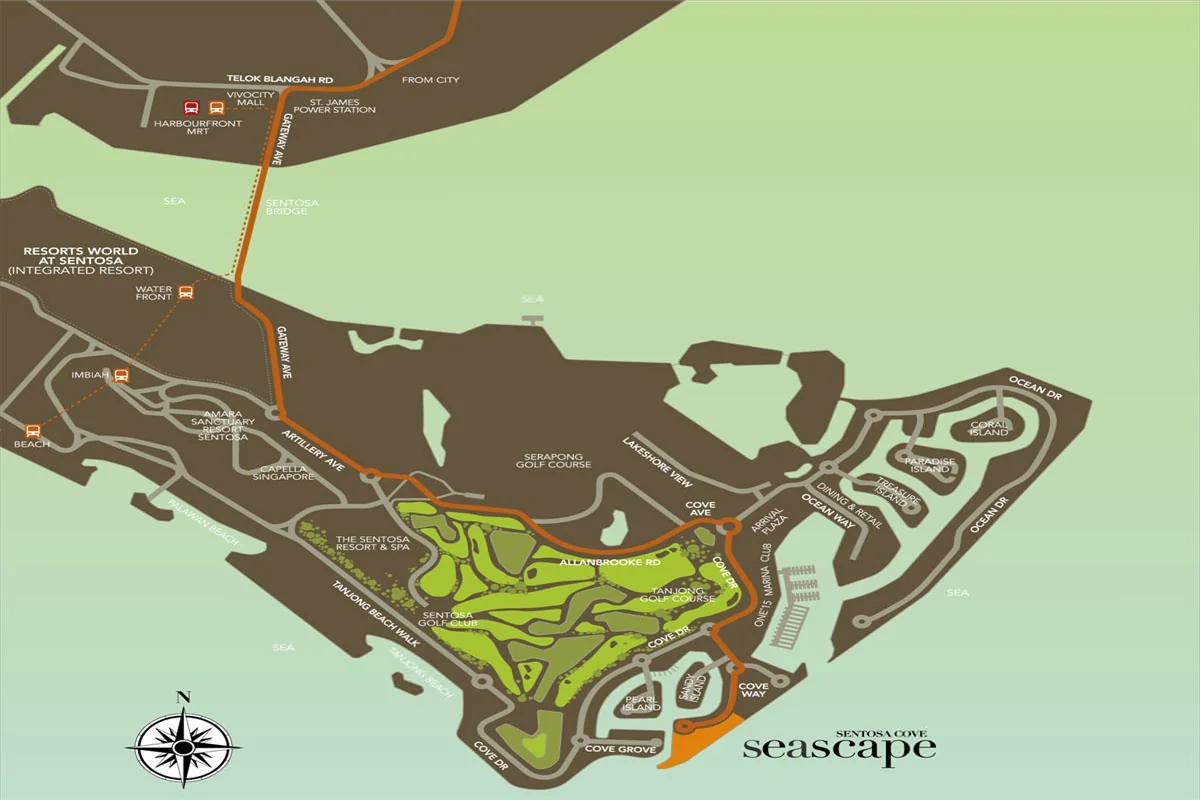
Cove Way leaves Cove Drive near the arrival plaza of Sentosa Cove and runs south past the houses of the enclave to the water, ending at Seascape. The developer’s location map traces the drive in: across the Sentosa Bridge from HarbourFront, along Gateway Avenue and Artillery Avenue, then Allanbrooke Road between the golf courses to Cove Drive and Cove Way.
From the site, the beaches of the southern coast run west, beginning with Tanjong Beach about a kilometre away; the golf courses lie inland; and the marina, the restaurants of Quayside Isle and the rest of Sentosa Cove sit to the north. Seaward, the view reaches the Southern Islands.
Seascape Distances
The distances below are straight-line measurements from the site on OneMap; routes by road are longer. They show what lies within reach of Seascape: the marina and beaches of the island and the islands offshore, then, across the water, the rail network, the schools and the city.
On Sentosa and offshore
| Destination | Straight-line distance |
|---|---|
| ONE°15 Marina club, 11 Cove Drive | about 0.7 km |
| Quayside Isle, 31 Ocean Way | about 0.9 km |
| Tanjong Beach | about 1.0 km |
| Sentosa Golf Club | about 1.1 km |
| Palawan Beach | about 2.0 km |
| Beach Station (Sentosa Express) | about 2.5 km |
| Sentosa Boardwalk | about 2.6 km |
| Resorts World Sentosa | about 2.7 km |
| St John’s Island | about 2.6 km |
| Kusu Island | about 3.1 km |
| Lazarus Island | about 3.2 km |
Across the water
| Destination | Straight-line distance |
|---|---|
| VivoCity | about 3.2 km |
| HarbourFront MRT station (NE1 / CC29) | about 3.4 km |
| CHIJ (Kellock) | about 4.1 km |
| Tanjong Pagar MRT station (EW15) | about 4.2 km |
| Radin Mas Primary School | about 4.2 km |
| Marina South Pier | about 4.4 km |
| Singapore General Hospital | about 4.4 km |
| Raffles Place MRT station | about 5.2 km |
| Marina Bay Sands | about 5.5 km |
Measured on OneMap (SLA) from the site, 27 October 2026. By road, HarbourFront MRT station is about 4.9 kilometres away and Raffles Place about 8.6 kilometres, by Google Maps on the same day. Home-school distance for Primary One registration is determined by the Ministry of Education.
The neighbourhood around Seascape
Sentosa Cove is the residential district at the eastern end of Sentosa, a place of waterfront houses, low condominiums, canals and a marina, with restaurants at Quayside Isle and the ONE°15 Marina club. Seascape stands at its southern edge, where the land meets the open sea; the anchorage of the Singapore Strait and the Southern Islands make up the view.
For days out, Tanjong Beach and Palawan Beach lie along the coast, Sentosa Golf Club inland, and Resorts World Sentosa at the western end of the island; VivoCity and HarbourFront are across the bridge.
Four area guides look further: the Southern Islands, Tanjong Beach and the southern shore, the Sentosa-Brani master plan and Marina Bay and the city.
Request the Seascape Price List
Seascape is completed and open for sale. The Sales Concierge sends the current price list and the homes still open for selection in 57 and 59 Cove Way. Showflat viewings are arranged by appointment through the Sales Concierge.
Sent on request
- The current price list and the homes still open for selection.
- The e-brochure and the floor plans you shortlist.
- The stamp duty for your profile and a loan estimate from the TDSR calculator.
- A showflat appointment at a time that suits you.
Request the Price List
No obligation. The Sales Concierge responds personally to every enquiry.
Prefer to speak to someone? Call +65 6200 6220, or send a WhatsApp message to the same number.